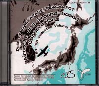
About this CD-ROM
This CD-ROM is a collection of data from aircraft and intensive ground-based
observation from 1991 to 1995, funded by Global Environment Research Fund for
Environmental Agency. The data were obtained through the project named
"Studies on the Behavior of Acidic and Oxidative Component in East Asia",
part of the Acid Deposition Area project.
This research was recognized as one of the sub-projects for IGAC/APARE
(International Global Atmospheric Chemistry Program/East Asian North Pacific Regional Experiment),
and carried out as a program of PEACAMPOT (Perturbation by the East Asian Continental Air Mass to the Pacific Oceanic Troposphere),
involving international cooperative observation and research with the researchers in China and Korea.
Data can be downloaded from here.
The Outline of the Yearly Observation, 1991 to 1995
1991
The 1991 aircraft observation was carried out from October 5 to 11, on the following courses.- 1) Nagasaki --> Yoron-Island (over the East China Sea)
- 2) Yoron Island --> Nagasaki
- 3) Nagasaki --> Seoul (over the Sea of Japan)
- 4) Seoul --> Nagasaki
- 5) Nagasaki --> Niigata (over the Sea of Japan)
- 6) Niigata --> Nagasaki
- 2) Yoron Island --> Nagasaki
1992
The 1992 aircraft observation was carried out from November 8 to 12, on the following courses.- 1) Nagasaki --> southeast of Cheju (over the East China Sea)
- 2) Izumo --> northeast of Oki Island (west of the Sea of Japan)
1993
The 1993 aircraft observation was carried out on the following courses.1994
The 1994 aircraft observation was carried out from December 12 to 14, on the following courses.- 1) Kagoshima --> over the East China Sea, west of Yaku Is. --> Kagoshima
- 2) Kagoshima --> over the Ohsumi Straight --> Kagoshima
- 3) Kagoshima --> over the East China Sea, west of Yaku Is. --> Kagoshima
- 2) Kagoshima --> over the Ohsumi Straight --> Kagoshima
1995
The 1995 aircraft observation was carried out from November 26 to 28, on the following courses.- 1) Niigata to the north of Sado Is. --> offshore Noto Peninsula--> north of Sado Is. -->Niigata
- 2) Niigata -->north of Sado Is. --> offshore Akita --> north of Sado Is. --> Niigata
How to Use This CD-ROM
As a hybrid format (ISO9660), this CD-ROM can be used both by DOS and Machintosh users.
The data of this CD-ROM are composed of the data books, vol.1 to 5, which have been already published. Open your browser, Netscape Navigator or Internet Explore, for example, and you will find the contents of texts, tables, and figures for each year. The texts were written by MS-Word, and the tables were written by MS-Excel. The figures are bitmap images.
To read these texts, tables, and figures, not only you have to use the browser above, but also open another software suitable for the data (MS-Word for texts, MS-Excel for tables and Paint or other graphic software for figures). Furthermore, your browser need to be set to read the data on corresponding software.
Even if there is no browsers installed on your PC, you can open the files by above software directly. The guide texts are in the following files of document directory.
- readme txt. (guide)
- bookcont.txt (contents of the texts)
- tabcont.txt (contents of the tables)
- figcont.txt (contents of the figures)

