

SATOH M., ROH, W., HASHINO, T.
CGER Reports
CGER’s Supercomputer Monograph Report Vol. 22
Evaluations of clouds and precipitations in NICAM using the joint simulator for satellite sensors
 PDF, 6.8 MB
Cloud-system-resolving models (CSRMs), that is, non-hydrostatic models using realistic cloud microphysical processes without cumulus parameterization, can reproduce the time evolution, structure, and life cycles of cloud systems. In recent years, increasing computer speed and resources have expanded CSRMs’ integration time and horizontal domain size, and it is possible for next generation climate and global circulation models to reproduce multi-scale interactions of cloud and precipitation systems. Many efforts toward evaluation of CSRMs based on in-situ aircraft observational data and ground radar observations have been made. However, ground radar observations and aircraft data have spatial and sampling limitations. In contrast, satellite data records are now long enough to provide sufficient data for the analysis of meaningful climatologies of cloud and precipitation properties, and therefore, do not have the above mentioned limitations. Retrieved physical parameters from radiance measurements of satellites such as precipitation amount and liquid/ice water content have many uncertainties in evaluating CSRMs for the spatial and vertical distributions of cloud and precipitation systems. It is known that one of the big uncertainties is the assumption of hydrometeors’ size distribution. In order to avoid this uncertainty, another approach has been used, i.e. comparing the radiances in satellite data with the simulated radiances in the CSRM’s output data using satellite simulators (Figure 1). Satellite simulators establish the same microphysical assumptions about hydrometeors, such as their size distributions and density, in both CSRMs and the simulators.
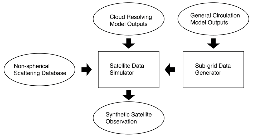
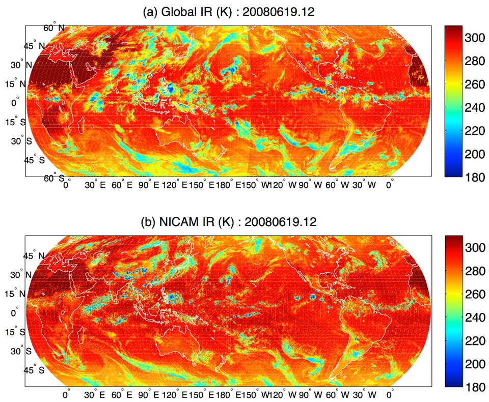
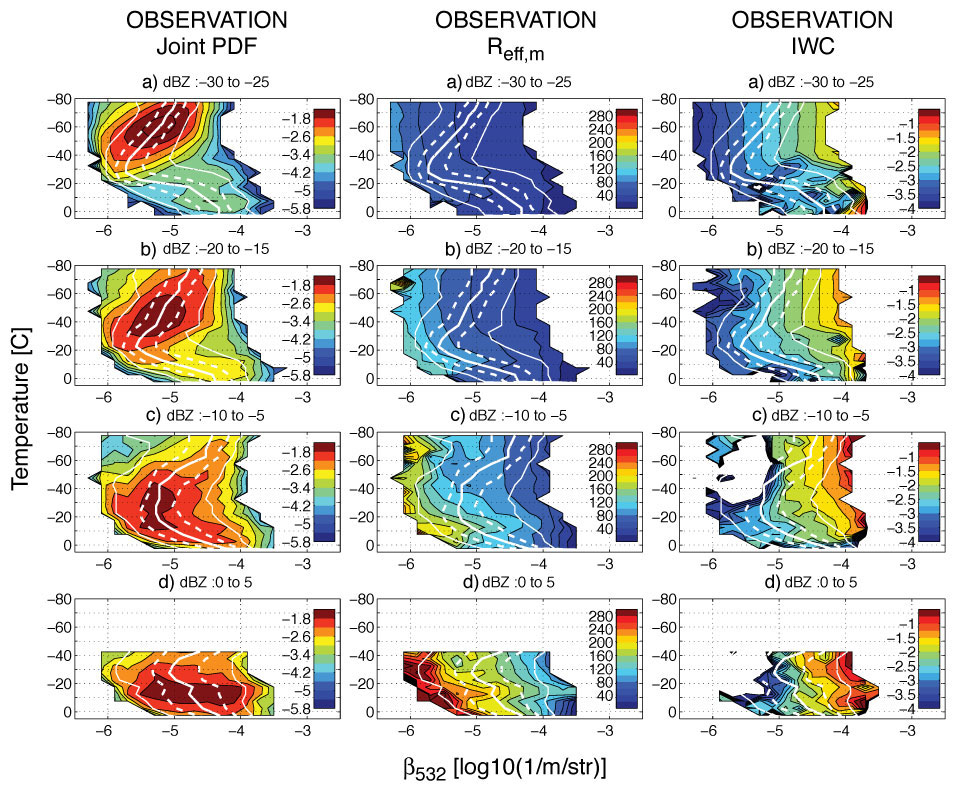
In this monograph, the Joint Simulator for Satellite Sensors (Joint-simulator), which was developed under the JAXA EarthCARE mission in order to simulate four sensors of EarthCARE satellite, is introduced as a satellite simulator. It can also simulate the radiances of multi-sensor satellites such as visible/infrared imager, microwave radiometer/sounder, radar, lidar, and broadband radiometer. Examples of simulated signals by the Joint-simulator are described (Figure 2). In addition, a new methodology for the Joint-simulator to evaluate the Non-hydrostatic Icosahedral Atmospheric Model (NICAM) simulations using CALIPSO and CloudSat has been devised (Figure 3, Hashino et al. 2013). We also introduce a study to improve the microphysics scheme in NICAM using TRMM and a satellite simulator (Roh and Satoh 2014).
This monograph shows that the Joint-simulator can be used to evaluate and improve the simulations of CSRMs and to reduce the uncertainties of the assumptions on hydrometeors used in CSRMs and satellite observations. The characteristics of observed microphysical properties from satellite data can be understood by using the Joint-simulator. The Joint-simulator also helps to develop and test retrieval algorithms for clouds and precipitation from synthetic satellite observations.
The present report is based on the following papers:
- Hashino, T., M. Satoh, Y. Hagihara, T. Kubota, T. Matsui, T. Nasuno, and H. Okamoto 2013: Evaluating cloud microphysics from NICAM against CloudSat and CALIPSO. J. Geophys. Res.: Atmos., 118, 7273–7292.
- Roh, W., and M. Satoh, 2014: Evaluation of Precipitating Hydrometeor Parameterizations in a Single-Moment Bulk Microphysics Scheme for Deep Convective Systems over the Tropical Central Pacific. J. Atmos. Sci., 71, 2654-2673.