


Project 1Characteristics of the variation of greenhouse gas concentrations and projections for the future
Results and future plans
Thanks to global observations by satellite, it has become possible to estimate column averaged CO2 volume mixing ratios. Using satellite data as well as data obtained in the current project, we develop techniques to estimate the distribution of CO2 fluxes. Figure 1 shows the world divided into 68 estimation areas.
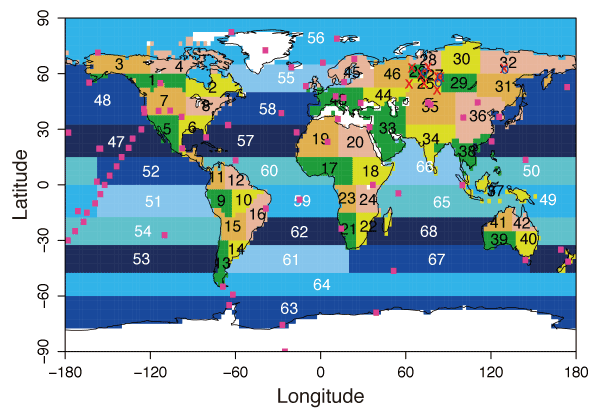
Figure 1.68 flux estimation areas
It was found that data obtained over India and Southeast Asia by aircraft measurements gave us new information on regional CO2 fluxes around there, since reliable data were not previously available in those areas. We hope to be able to obtain even more detailed data in the near future. It has been shown that the data on the vertical distribution of CO2 obtained by aircraft observations, in combination with data from ground-based monitoring stations, provide extremely good information on global mixing patterns in the atmosphere. There had been almost no information about the mixing of air between the northern and southern hemispheres, but through the aircraft observations in our project the mixing patterns have been clarified.
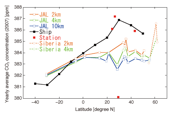
Figure 2.Vertical distribution of CO2 at different altitudes
Since not only anthropogenic combustion of fossil fuels, but also other phenomena such as forest fires can be a source of CO2 emissions, it is thought that observing carbon monoxide (CO) and methane (CH4) could give a good indication of CO2 emission sources in Southeast Asia. Therefore, data obtained by high frequency ship-based observations in recent years will be able to provide valid information. Figure 3 shows the distribution of CO concentrations obtained by ship-based observations, reflecting the regional distribution of CO emissions originating from forest fire in Southeast Asia.
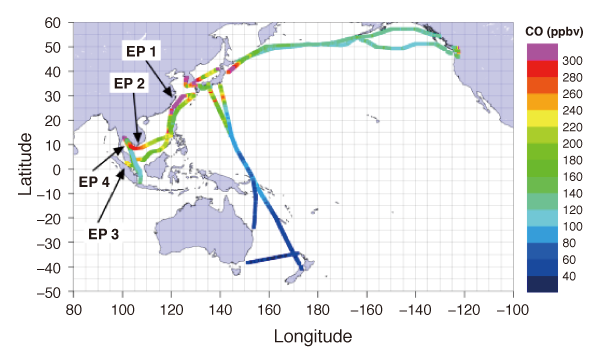
Figure 3.CO measurements by regular ship service on the Asian route between December and February
In the current project, we undertake also observation of terrestrial and oceanic CO2 fluxes. Especially for the Pacific Ocean we develop CO2 flux maps with even higher accuracy. By integrating the observations in the atmosphere and flux measurements we aim to further improve the estimation accuracy of global CO2 fluxes.
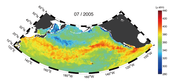
Figure 4.Pressure distribution of CO2 above the ocean estimated by neural network